I had wanted to
hike up City Creek Canyon Road. The last time I had gone up there, I had been having too much fun along the way and never made it to the end. The end of the road was my goal today. I bet someone who has seen lower City Creek Canyon is already screaming "That trail is paved. That's not a hike--that's a walk." And in a way they'd be right. My intention when I set out this morning was to walk up the paved road all the way to the end of it, and then step past the gate onto the actual
trail. As you will soon find out, stepping past the gate onto the trail was the
only thing I did that followed that plan. And several miles of it ended up being a real hike. Let me explain.
The
walk began from the parking lot east of the Utah State Capitol Building. I started walking down the one-way road to where the City Creek Road split off and headed up the Canyon. As I walked the road east of the Capitol down, I looked across the canyon and wondered how I could get onto the other end of this road, so I could
drive to the City Creek parking area, instead of walk past it after the turnoff. I thought that if I got back down soon enough, I would drive over to the other side and see if I could find the road.
One of the decisions I had made was whether or not to wear my ski jacket or my thick flannel shirt that I got for Christmas. The flannel was really warm, even for flannel so I thought I might be okay with just that. I decided on the flannel and left the ski jacket in my vehicle. At first, I thought I had made a mistake because the morning air (I began hiking at 7:51) was cold and there was a light breeze that was freezing my face. Later on though, after walking for a while, the flannel seemed to be perfect.
I got to the gate at the far end of the canyon parking lot and looked at the map.
It was 5.6 miles to the last picnic area on the map, and just a short distance further, the turn around where the real trail, Meadows Trail, headed up into upper City Creek Canyon.
The
clouds were amazing as I hiked. I took several shots of them and could have taken many more.
I also noticed that there were several
side trails, and there was a trail that paralleled the road for much of the distance.
I found myself getting a bit tired, because
I had climbed over 200 floors on the stair climber the day before, but I soldiered on.
Just after the three mile mark I passed a building marked "City Creek" which I think was the water providing utility for part of Salt Lake County. About a quarter mile past that, prior to the 3.5 mile mark, the plowing ended and a packed snow trail took off along the road.
 |
| The plowing ended about 180 yards shy of the 3.5 mile mark. |
I hadn't counted on the road not being plowed all the way, but I had set my time limit to be three hours up, so I decided to stick with the plan and try and make it to the end of the road by the time my three hours was up, which would be at 10:51 if I wanted to be exact.
At first, the snowy trail was well used, but as time went by and I got closer to the five mile mark, it looked like more and more people had decided to turn around and the trail was becoming less and less of an actual trail. Right after I reached Rotary Park, the trail really dwindled down.
 |
| The trail after I reached Rotary Park became much less used. |
I was thinking that a lot of people must have had Rotary Park in mind as their goal and went back down once they reached it.
That wasn't
my goal. My goal was the end of the actual road and the beginning of the actual trail. In another mile or so, I finally made it, a couple of minutes past my three hour limit, but nothing to sweat about. My watch said 10:53.
 |
| The turn-around before the final gate. |
 |
| The Meadow Trail, heading up after the final gate. |
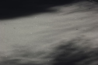 |
| Sparkling ice crystals in the snow, hard to capture with a camera. |
 |
| Service vehicles? Always present? I think they're exaggerating. |
On the way back down, I took a few more pics, sat and ate a banana,
and struggled back to the
4runner (Yota) as my legs began feeling like lead over the past three miles.
In all, counting the extra walk from the Capital Building, I had covered 13.2 miles.
Since my legs were so tired, I really wanted to go find out where that road started on the other side of the canyon so I would never have to park at the Capitol and walk that stretch again, so that's what I did. It wasn't until I got home and began looking at pics that I noticed the coordinates for that one way road were on the lower left corner of the map in the picture of the map above. By the time I was done with that, I was starving. I had only packed a
peanut butter and jam sandwich, which I had eaten at just after 9 am, and a banana, which I ate on the way down. I was thinking that I could probably eat half a pizza, which reminded me of when I had done the Half Dome hike in Yosemite, a 17 miler with lots of steep parts and I had only taken six Clif Bars along. That provided about 1200 calories. The strenuousness of that hike burned about 4000-5000 calories. When I got back to Curry Village that day, I ordered and ate a whole pizza. I wasn't feeling quite that hungry this day, but I was pretty famished. I ended up ordering takeout at Pat's BBQ, and then as I neared home, I ordered something from Sonic. I had been thinking about picnics for much of the day.
 |
| A list of the picnic areas in City Creek |
Today ended up being a great
adventure. Some of it expected, some of it unexpected, but all of it a blessing.


No comments:
Post a Comment