 |
| Bison are frequently spotted on the island. |
I think one of the most interesting hikes around the Salt Lake Valley, is the hike to
Frary Peak on
Antelope Island. The actual elevation of the peak (6596 ft.) isn't high in relation to the peaks of the
Wasatch or
Uinta Mountains--or even the tallest peaks in the
Oquirrhs--but the landscape is entirely different. Pretty much barren of trees, although there are a few junipers here and there, and down in the ravines you can see small clumps of oak, maple, or some other deciduous trees, the landscape is mostly grassland and sagebrush. And the geology is different as well with dark rock outcroppings appearing throughout the peaks and ridges of the island.
The
hike itself is best done in a season other than summer as I would wager that it gets pretty hot in the summer months and there is virtually no shade. Fall is the perfect season to do it, and my brother Mike and I found out to our relief that the no-see-um flies had maybe died off for the year. I wouldn't bank on that though. Antelope Island is always a place where you should have bug spray on hand as there are times when the biting flies can be maddening.
Wildlife is plentiful if you take the time to search it out on the hillsides and down in the flatlands. Bison are often seen along the trails and from the ridges you can look down and spot groups of them feeding on the grasses. Saturday, when Mike and I went on our hike, we spotted numerous buffalo and on the way out, a herd of
deer down in the lowlands. Some others along the trail had spotted a Bighorn sheep and other wildlife that we hadn't seen.
 |
| At this low altitude, wildflowers are still around if you look. |
 |
| This sunflower was calling my name. |
Early portions of the trail are steep as it makes its way up to the ridge. There is a 2050' elevation gain over the course of the hike, and much of that is in the first mile. Once you are up high, it levels off and only occasionally climbs or drops steeply, most of the time the trail crisscrosses the ridge allowing views of the Great Salt Lake to the west, and the Wasatch Range to the east. The higher you get, the more expansive the views and you can see south to the Oquirrh Range, Southwest to the
Stansbury Range, Stansbury Island directly west, Promontory Point way up north, and many other points of interest.
 |
| View west with Stansbury Island in the distance. |
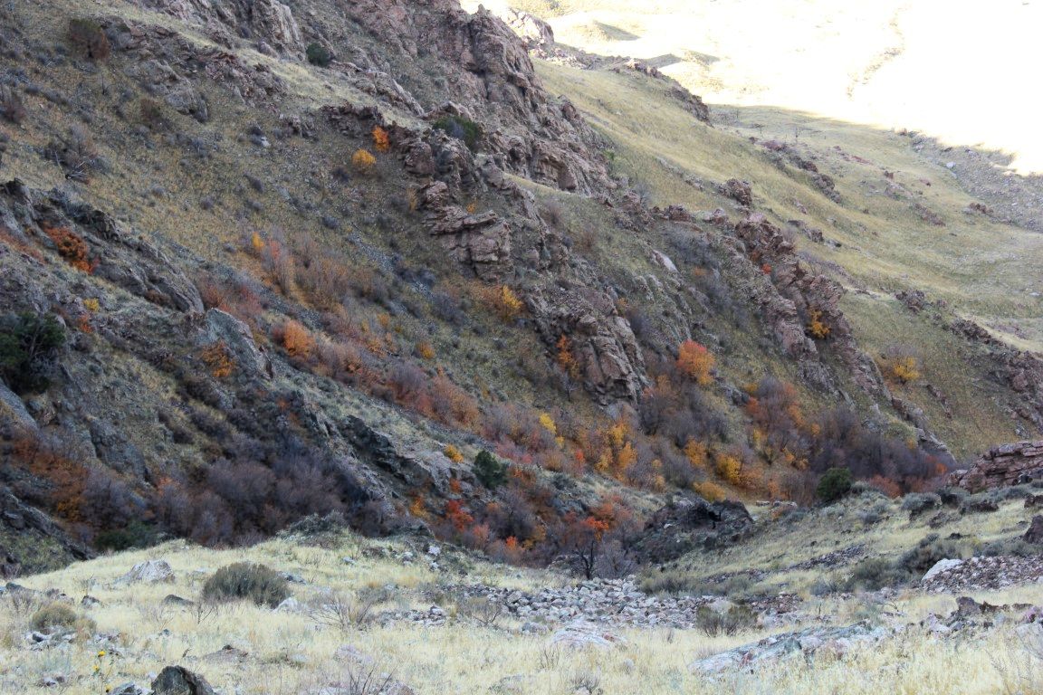
 |
| There are still some fall colors on the way to Frary Peak |
 |
| Stansbury Island with whitecaps on the lake in the foreground. |
The trailhead sign says that it's a 3.2 mile hike and there are markers every half mile along the trail. I think that the 3.2 miles is a bit off now, because they have redone the trail on the last portion in the past couple of years and it is longer as it curves around the peak and goes up gradually, instead of the nearly straight up "stairs" from years gone by. I don't think they have yet changed the mileage posts to reflect this new trail, but I would guess it added another quarter mile to the trek.
 |
| I got a bit higher and took a pic of Mike down on the trail. |
That being said, it's a doable trail for most people who aren't in horrible shape. If you are not in great shape, going slowly will help you to make it to the top, where the reward for the effort is pretty amazing.
 |
| Mike looking like a viking explorer. |
On top, look for the USGS marker. It's on top of a rock right where the trail gets to the top. That is the highest point, and it's worth standing on just so you can say you made it to the very top. The cairn in which a mailbox is placed for writing notes may be a bit higher, but my recommendation is that you avoid standing on that, as it will fall down, and you with it.
 |
| Don't stand on the cairn!! |
You won't find lodgepole pines, aspen, or thick underbrush up here. What you will find especially if you can go during the week, is peace, and solitude, unusual landscapes, and amazing views. Well worth the few hours of your time to do this
adventure.
 |
| Looking southeast from the trailhead, Wasatch Mountains in the distance. |


No comments:
Post a Comment