Showing posts with label hike. Show all posts

Saturday, June 09, 2018

Hiking: Uinta Lakes near Bald Mountain


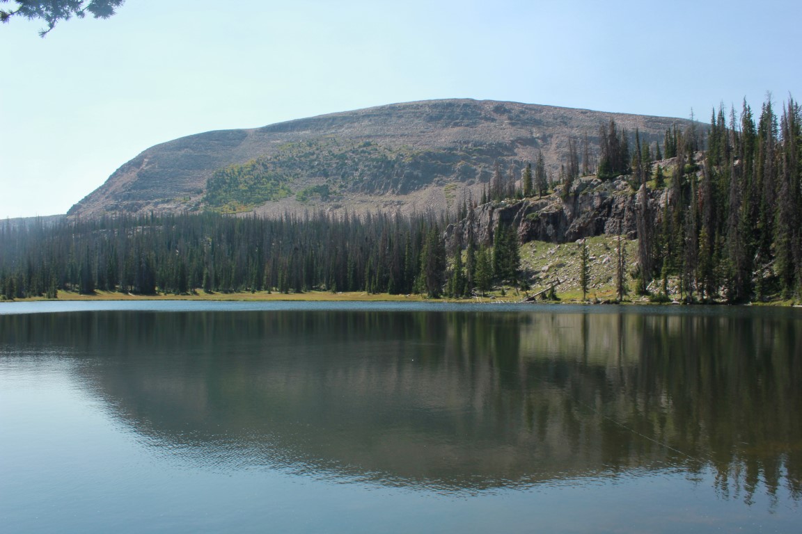
Clegg Lake with Reids Peak in the background
Bald Mountain, more affectionately known as "Baldy" looms at the summit of the Mirror Lake Highway, a huge sentinel among many.
I did my best to get at least some images of these Sandhill Cranes
that I saw along the highway.

As soon as I stopped my vehicle, the birds decided to walk away. I had no time to grab the longer lens.
The hike to the top of Baldy is relatively short (2 miles) with spectacular views of the Uintas, and over to the Wasatch. I had done that hike several times in the past. Friday I was up for something I hadn't done. Ever since I had found the trailhead to the top of Baldy though, I had wanted to take the fork in the trail that headed over to some lakes and see what that was like. I was not to be disappointed.
The trail begins as part of the same trail that will take you to the top of the peak, but diverges very quickly and is unmarked. There is a fork about fifty feet after you start up the trail. The left fork heads over toward the picnic tables that are visible. If you want to go to the lakes, instead of the top of Baldy, that's the trail to be on.
To get to the lakes, take the trail that heads toward the picnic table (in trees, top left).
To climb Baldy, follow those people in the pic.

A brown Forest Service sign in this pic (top right) shows the way to the top of Baldy.
Some shallow cornices still on Baldy's edges.

Bald Mountain isn't quite as bald from this angle.

Reids Peak left, and Baldy right.
For the most part, the only way to go on this trail is down as you are pretty much at the highest point when you begin. Nevertheless, the trail is only steep periodically and had both uphills and downhills, some rocky sections, some not so rocky. This time it had some pockets of snow across it in several places, after all, it's still early June. If we would have had a normal or heavy snowfall winter, there would have been even more snow remaining.
As it was, there was a lot of water both on and off the trail. I expected a lot of mosquitoes because of the amount of water, but I only saw one, and that was when I was getting my pack ready to start down the trail. I killed that one, so if that was the only one, you're good.
I was heading for four lakes or really to see how far I could get in the time I had allotted myself, and depending upon how long I spent fishing or doing non-planned explorations. The four lakes I had in mind were Clegg, Dean, Notch, and Bench.
Lots of water with these white flowers.

Closeup of one of the daisy-like blooms.

Spectacular meadows. A lot of dead trees--probably from pine beetle.

Since this is part of the trail that you can begin at Crystal Lake trailhead and hike up to the Bald Mountain trailhead, or visa versa, I could've conceivably gone quite a bit further. There was no way I was going all the way to the Crystal Lake trailhead though as I'd have to walk back, either up the road or back the way I had come on the trail. That would have made for a very long hike.
Patches of snow like this were frequent across the trail.
I was moving pretty slow for the first hour or so, taking a lot of pictures, and checking things out. I think I was forty-five minutes in before I made it to the first lake, Clegg, just behind a group of three that had passed me shortly before.
Clegg Lake

Clegg Lake II

I took several pictures and then headed on towards Dean Lake. However, the next lake I actually found was Notch Lake, my planned fishing destination. I had re-passed the three people at Clegg, who had stopped for some snacks and they caught up with me again at Notch as I was heading down to fish. The lake itself was Beautiful. I could have sat there all day and just looked at it, and I probably should have.
Notch Lake
Something about the look of things told me that fishing would be slow. No indication of fish feeding--no circles on top of the water, no jumping fish. I baited my hook and cast it out. A wind had picked up making it difficult to see the bubble. I didn't want to waste a lot of time if the fish weren't biting. That wasn't the main reason I had come anyway, so after about twenty minutes, I decided to pack up and head further down the trail to Bench Lake and see what that looked like.
Bench Lake
It wasn't far--maybe another 5-10 minutes and I was there. It had the same lifeless look as Notch Lake had, so I didn't even bother to get a worm in the water. But the landscape was amazing! I couldn't help getting into my virtual John Denver "Wow!" mode.
I wondered if I could make it down and around the short row of peaks and follow it around to Ibantik Lake, which was the furthest I had been on that trail from the Crystal Lake Trailhead and thus would allow me to say that I had been over the entire trail, but never from trailhead to trailhead. Ibantik though was a lot further than I had planned on traveling and it would have to wait for another day.
I started back toward the trailhead, planning on trying to find the missing Dean Lake along the way. On the map it had appeared to be set off the trail a ways, so I thought maybe I just hadn't looked at the right time through the trees to spot it. I had left my Garmin GPS at home this time and I really could have used it.
When I passed Notch Lake on the way back I began looking for Dean Lake. I never saw it and finally found myself at Clegg Lake. That must be Dean I thought. It looked like a straight shot down from there, so I headed down. When I got there, I was not disappointed for taking a little more adventure time to find it. I think it was the prettiest of all the lakes and all of them had been Beautiful.
Back at Clegg, I decide to go up the high rocks to the right to find Dean.

I went up to the top of these and looked down, spotting Dean Lake
Off to the right was a rocky ridge and I climbed that  hoping that from there I could maybe spot Dean Lake down below somewhere. It was a good plan and it worked. Far below in the distance, I saw the edge of a body of water.
I followed some rocks, then this meadow down to Dean Lake, (barely visible top).
There were a couple of fire rings around, so people had hiked in here and camped and since it was harder to find, it was probably a little more solitary than some of the other lakes as far as getting away from crowds. I noted in my mind that I might someday like to come back here and spend the night, or have a picnic or something. I was thinking too, that this whole area would be great for GPS hide and seek or something like that.--you know, someone saying "here are my GPS coordinates--come and find me"--that kind of thing.
If you follow this meadow by this curved bridge down, it will take you to Dean Lake.
I looked for any kind of trail leading away from Dean that went back to the main trail, but couldn't find one. I assumed people just walked through one of the many meadows or down the rocks like I had done in order to get there.
I stopped and took a final picture of Clegg Lake and Reids Peak.
I headed up to the main trail and back to the vehicle. I had begun my hike at 7:45 and was done a little after 1:00. I wished I could have stayed all day--even for several days--but that was something that would have to wait for the future.
Resting on a log near Dean Lake.
As for now, I was happy to have had a few hours escaping into "God's Country" and a few adventurous moments. The rewards are always worth the effort up there as far as I'm concerned.

Saturday, September 09, 2017

Hiking: Bald Mountain and Fehr Lake

This past Tuesday I wanted to get out, get hiking and try some fishing. Mostly, I wanted to get into the Uintas as I hadn't had the chance to go there yet this year. I had debated which lake I wanted to hike to in order to fish, and I kind of wanted to try somewhere new. Then I decided to hike to the top of Bald Mountain, a relatively short hike, and come back down, then hike to one of the lakes off the same trailhead that goes to the top of Baldy.
I had told my wife that I'd be back at around 4:00, so I had to keep that in mind as I was figuring things out. I driven out of the gas station parking lot in Taylorsville at around 6:20 and it was just shy of two hours drive time by the time I got there. I had stopped to go through the McDonald's drive thru at Park City, and to pick up a fishing license, some worms, and some Power Bait at the grocery store in Kamas. I didn't need to pick up a pass at any of the kiosks or whatever you call them along the Mirror Lake Highway, as my pass that I had purchased the day before, when my wife and I took a drive up there, was still good.
Saw these deer on the drive up. Just did a drive by experiment with my zoom.
As I began hiking, I started thinking that maybe I should've brought the short-sleeve shirt instead of the long-sleeve, because I was working up a sweat. And I had not been up at altitude like that all year--Bald Mountain Pass clocks in at over 10,700 feet, and the trailhead itself is just a bit lower than the pass. My legs were fine from all the stair climbers I've been doing, but I found myself lightheaded as I tried to adjust to the thinner air.
There was only one other car in the parking area when I began, which was quite a change from the day before, which was Labor Day. That day, there was wall to wall people all through the Mirror Lake highway area. In fact, on Monday we had got caught in bumper to bumper traffic coming back from our ride--people from the Uintas, and likely Strawberry Reservoir and other areas too. Tuesday was completely different and back to nearly normal levels of people, though there were still a few campers and motor homes belonging to people who probably wanted to stay up for a few more calmer days.
As I began my ascent, I could tell it was going to be a low visibility day due to the smoke from all the fires that had accumulated amongst the peaks. At that point I was not aware of the Weber Canyon fire, and thought that most of the smoke was blowing in from other states.
It's quite a slope, both to the right and left as you go up the trail.
I kept it slow to better adjust to the altitude and took a lot of pics along the way.
This is about where the woman who had climbed it 100 times passed me.
One woman passed me on the way up and then, just as I neared the top, she passed me on her way down. We stopped and chatted for a few, and I found out that this was about her 100th time climbing this particular peak. I had just heard a couple of weeks ago about a retired mail carrier who had hiked to the top of Mt. Timpanogos more than 900 times. It made me wonder. I mean, there are so many different trails to take, why do one particular trail that many times? But to each his or her own. I have hiked several of the trails in the Wasatch around five times and Mt. Olympus maybe ten times. That would be my personal record. The most times I've hiked any one particular peak. And I don't necessarily see me doing Oly again. So many trails, so little time!
After talking to that person, I got up to the top and hung around for a while, finding the exact top with my GPS (this mountain tops out at 11,943 feet) and then going to various points to see the 360 degree view.
Looking to the southeast. That's Mirror Lake directly below.

A little to the northwest is the Notch.

Another view of Mirror Lake and Highway 150

To the west. Among those lakes are Trial and others.

Reid's Peak

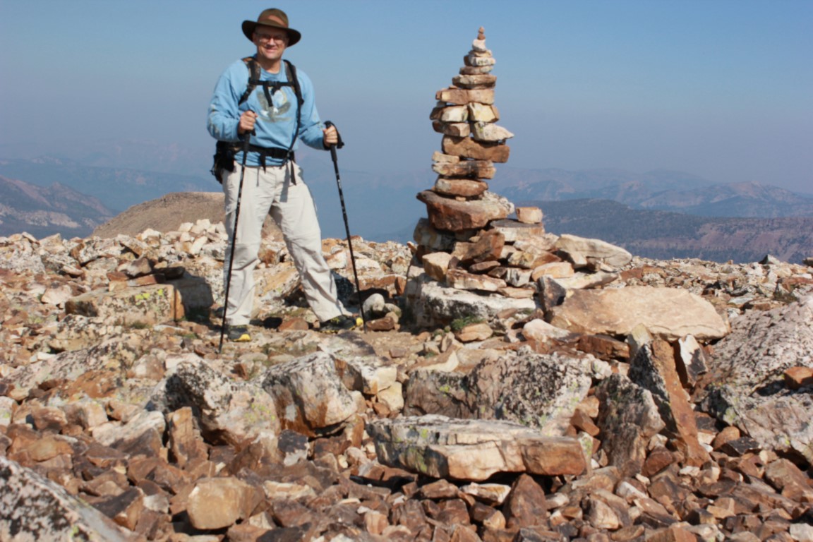
Large cairn on top. The actual high point is where I am taking the picture.
After eating my second breakfast, I headed back down. On the way, I met a couple of people from New Zealand who were camping nearby and enjoyed my visit with them. before I even got to the trailhead, I realized that I wasn't going to be able to hike into even the nearest lake along the other fork of the trail. This trail eventually leads to the Notch, and one can do a point to point hike if you start here and end up at the Crystal Lake trailhead, or start at that trailhead and end up at the Bald Mountain parking area. I certainly want to do that one some day. I have hiked from the Crystal Lake trailhead over the Notch and down to Ibantik Lake and that is a fabulous hike.
Anyway, I had spotted a lake on my map on top that was only about a half mile from the main highway, and I drove down the highway to the parking area, then hiked into Fehr Lake. I figured I had about an hour and a half to fish in order to get home by the time I had told my wife.
Fehr Lake is a Beautiful little lake.


Can you find the guitar in this image?

There are other lakes further back in. As I said--there are so many hikes, and I love Timp and all, but could never see me doing it even 100 times--just too darn many other places to see. One of these days, I'll get back on that trail and see the other lakes that were further in.
Views along the trail to Fehr Lake
Since I had an hour and a half, I just decided that my best course of action in catching fish was to try something for 20 minutes, and if there were no bites, to try something else. I first used worms. After all, I had stopped and bought them in Kamas, so I figured I'd better give them a try. Nothing. The Power Bait was next--rainbow with sparkles. Again, nothing. I decided to try a fly with a bubble. I used a brown scud and a fish took it, right after it hit the water. I reeled it in. If I had my backpacking stove with me, I would have cooked and eaten it on the spot, but I didn't, so I let it go. I let nearly everything go when I fish as it's rare for me to have my stove along, and I never take them home.
I tried the scud a few more casts, but got nothing. I figure that the fish hit it on that one cast because it was still basically dry and they were feeding on the surface, but after that first cast, it was waterlogged and sunk. Something to think about for the future. I should take my fly rod next time and that stuff that makes flies float.
I switched to spinners and caught nothing except an empty plastic cup that some uncaring person had thrown down, either in the lake, or on the land and then it had blown in. Either way, I didn't like it.
You can stop leaving your trash in the mountains at any time. I won't complain.
The trail back out afforded me a great view of the peak I had summited earlier that day.
Bald Mountain
I knew I would be back to climb it a fourth time some day---probably in my golden years--and then stopping in the forest below for a picnic or something. One thing I knew for sure--I would never run out of places to hike, for the first time, or for the seventh. And it's always a new adventure.

Tuesday, January 20, 2015

Day five...
Today we got up early and I took Ann to visit with her sister, Debi. Then my brother-in-law, Morris took off to the Superstition Mountains do a little driving around on his Ranger, up to a trailhead to a place called "Rogers Trough". This trail is an 8 mile round trip and leads to some cliff dwellings. It starts out by going downhill. We made good time and  got there around noon. Here are some pics of the area.

Shane at cliff dwelling in Rogers Canyon


Morris at cliff dwelling in Rogers Canyon
This sign was posted in front of the cliff dwellings
I tried to climb into the upper cave, but the way was slick and I had only my running shoes...I had not brought my hiking shoes because that would have necessitated me bringing four pairs of shoes on the trip. Little did I know that I would actually need the hiking shoes.

After viewing the caves and the dwellings, we ate lunch, then started the uphill hike back to the Ranger. It was tougher going up than coming down, but we made it. We drove back down to the trailer (passing by some of the coolest mountains ever, strewn with saguaro cacti), loaded up the Ranger, drove to town, showered and Debi and Morris went with me and Ann out to dinner to Casa Reynosa. It's a place that Debi and Morris frequent and is very good.