Sunday, December 24, 2017

When My Heart Finds Christmas

When Harry Connick Jr. penned the song, When My Heart Finds Christmas in 1993, little did he know it would become a classic among Christmas songs, let alone Christmas love songs. Although Michael Buble has gone on to become perhaps a better crooner than Connick, Connick's biggest Christmas hit ranks right up there with the best of Buble's Christmas offerings. (Sorry, I can't figure out how to do the accent on the "e" in "Buble".) The words to the song are simple, however, the music is sentimental and filled with feeling and when Connick sings it, it sounds like he means it. It is on all of my Christmas favorites lists. The video is of a much more recent performance of Connick doing the song. Happy Christmas Eve!

Tuesday, November 28, 2017

Forty minutes of pain

My newest workout at the gym is what I call "Forty minutes of pain". It's really refreshing. What that involves is forty minutes on the stair climber. I have recently bumped this up to forty. It used to be thirty-eight, and I will still do shorter time periods when I don't feel up to the forty, or when my time doesn't allow me to complete forty minutes. But today, I did the forty and it was forty minutes of pain. I began the routine doing 71 steps per minute, then increased by 1 step every four minutes, until I got to 28 minutes, after which I increased by one step every three minutes. My goal was to burn off 700 calories. I didn't quite make the 700 by the end of the forty minutes, but after about 44 minutes (the last four part of the cool down) the calorie counter registered 700 calories burned. I also burned a few after the stairclimbers as I did my abdominal workout today. Here are the vital statistics:

Minutes: a little over 44
Floors: 191 (at about 17 steps per floor)
Steps: 3247
Calories burned: 700 (maybe 75 more doing the ab workout)

There's one more statistic that's worth noting:

Pieces of pie burned off: two

So there you have it, I have burned off several pieces of pie since Thanksgiving, but still haven't burned off all of the pie and other things I've eaten. Thus go the holidays. I also have a much harder time making it to the gym to do said workout from about mid-November through the end of the year, simply because my job as a mailman gets pretty crazy during that time period.

The bottom line is that forty minutes of pain is worth it to me so that I can do the things I love, which includes eating.

Sunday, October 22, 2017

Hiking: Antelope Island, Frary Peak

Bison are frequently spotted on the island.
I think one of the most interesting hikes around the Salt Lake Valley, is the hike to Frary Peak on Antelope Island. The actual elevation of the peak (6596 ft.) isn't high in relation to the peaks of the Wasatch or Uinta Mountains--or even the tallest peaks in the Oquirrhs--but the landscape is entirely different. Pretty much barren of trees, although there are a few junipers here and there, and down in the ravines you can see small clumps of oak, maple, or some other deciduous trees, the landscape is mostly grassland and sagebrush. And the geology is different as well with dark rock outcroppings appearing throughout the peaks and ridges of the island.

The hike itself is best done in a season other than summer as I would wager that it gets pretty hot in the summer months and there is virtually no shade. Fall is the perfect season to do it, and my brother Mike and I found out to our relief that the no-see-um flies had maybe died off for the year. I wouldn't bank on that though. Antelope Island is always a place where you should have bug spray on hand as there are times when the biting flies can be maddening.
Wildlife is plentiful if you take the time to search it out on the hillsides and down in the flatlands. Bison are often seen along the trails and from the ridges you can look down and spot groups of them feeding on the grasses. Saturday, when Mike and I went on our hike, we spotted numerous buffalo and on the way out, a herd of deer down in the lowlands. Some others along the trail had spotted a Bighorn sheep and other wildlife that we hadn't seen.
At this low altitude, wildflowers are still around if you look.
This sunflower was calling my name.

Early portions of the trail are steep as it makes its way up to the ridge. There is a 2050' elevation gain over the course of the hike, and much of that is in the first mile.  Once you are up high, it levels off and only occasionally climbs or drops steeply, most of the time the trail crisscrosses the ridge allowing views of the Great Salt Lake to the west, and the Wasatch Range to the east. The higher you get, the more expansive the views and you can see south to the Oquirrh Range, Southwest to the Stansbury Range, Stansbury Island directly west, Promontory Point way up north, and many other points of interest.
View west with Stansbury Island in the distance.

There are still some fall colors on the way to Frary Peak

Stansbury Island with whitecaps on the lake in the foreground.
The trailhead sign says that it's a 3.2 mile hike and there are markers every half mile along the trail. I think that the 3.2 miles is a bit off now, because they have redone the trail on the last portion in the past couple of years and it is longer as it curves around the peak and goes up gradually, instead of the nearly straight up "stairs" from years gone by. I don't think they have yet changed the mileage posts to reflect this new trail, but I would guess it added another quarter mile to the trek.
I got a bit higher and took a pic of Mike down on the trail.
That being said, it's a doable trail for most people who aren't in horrible shape. If you are not in great shape, going slowly will help you to make it to the top, where the reward for the effort is pretty amazing.
Mike looking like a viking explorer.
On top, look for the USGS marker. It's on top of a rock right where the trail gets to the top. That is the highest point, and it's worth standing on just so you can say you made it to the very top. The cairn in which a mailbox is placed for writing notes may be a bit higher, but my recommendation is that you avoid standing on that, as it will fall down, and you with it.
Don't stand on the cairn!!
You won't find lodgepole pines, aspen, or thick underbrush up here. What you will find especially if you can go during the week, is peace, and solitude, unusual landscapes, and amazing views. Well worth the few hours of your time to do this adventure.
Looking southeast from the trailhead, Wasatch Mountains in the distance.

Wednesday, October 18, 2017

Hiking and Four-wheeling: American Fork Canyon

The Moon was Beautiful low in the eastern sky

I have been on vacation this week and with our original plan of spending two nights in Colorado canceled, I figured I could hike twice this week. Today was the first one. On the agenda was the Tibble Fork Loop hike, which I had heard a lot about, but never done.
I got up early, hoping to see the sunrise while I was up there, and actually I got up there a lot faster than I thought I would and sat back in the new Tibble Fork parking lot to try and get some pictures of the little smile of a moon that was rising in the eastern sky.
Once it started getting light, I headed over to the dam as that was where the trail head was supposed to be. I parked down below it, on the pull out area between the road and the dam. Once I crossed the dam I could see the trail, or what I believed to be the trail, heading up the side of the hill. There were a couple of spots of yellow ribbon around the base of the trail.
I went back later and took these two pics of the trailhead when it was light.

Same picture, but from a distance back on the dam.
I wasn't quite sure that it really was the trail because A) there was no sign indicating so, and B) there was a trail going off to the left, as if it was going to circle the reservoir. I decided that the one going along the side of the lake was not the trail, so I skirted the ribbon, trying to avoid the eroded areas, and worked my way up the trail.
Once on the trail I found that someone had cut trees and branches and put them across the trail.
They had to cut down a lot of scrub oak to cover this trail.
It was definite that someone was trying to discourage hiking on that trail, but I kept going--mostly because there hadn't been a sign at the trail head indicating that the trail was closed. After a while of climbing over the branches, the trail met another one angling in from the left and the branches and small trees no longer covered the trail.
I was able to get up high early enough to catch the light on nearby
peaks.

I made my way up through scrub oak and maple, and then gradually, found myself amongst the quakies and pines as I climbed in elevation.  At about this point it dawned on me that I had forgotten to pay the fee that is charged for doing anything in American Fork Canyon. I had heard of some people who had gotten caught for that and had ended up paying a hefty fine, and I debated heading back down the way I came. But I decided I would just hike fast instead. In a few minutes, I found a junction and one trail headed left over to Mill Canyon, the other part of the loop was that way.
The trail to the right led to Mud Spring. I turned and looked at the other side of the sign, as if I was coming up from the Mill Canyon side and saw that the trail I had come up had officially been closed.
Yep. I had come up the closed trail. Oops!
I had actually been surprised by all of this because it seemed like I had seen several trip reports from people hiking this loop, and none of them had mentioned the closure. Maybe it has been very recently that they have closed it. And there was no actual sign on the Tibble Fork end that noted the closure. I felt bad, but there was really nothing I could do at that point.
I still wasn't sure I was on the right trail though because I hadn't really studied the map and didn't actually know the name "Mill Canyon" so it didn't really mean anything to me on the sign. I met two women coming up and they confirmed that I was on the trail that looped back. One of them was wearing something that to me looked like ranger clothing so I was a bit worried that I might get in trouble for hiking up that way I had. But there had been no badge, so I figured that her hiking clothing just kind of resembled ranger gear and that she was just another hiker.
In the midst of peace and contentment, there are still signs of civilization.
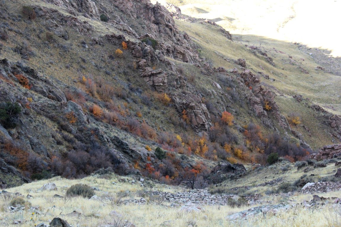
You can still find pockets of color.


The reds are hard to come by now.

Up there at the top, the trail meanders through some large meadows. There wasn't a lot of color left--just patches really---but it was still Beautiful. There is another fork in the trail and it was pretty self-explanatory.
The next sign I saw showed me the way back to Tibble Fork where I was parked.

And it smelled so good and clean up there! I made my way down Mill Canyon, taking pics along the way, still a bit worried as to whether or not I'd have a ticket waiting for me on my windshield.
Looking north 
Stream crossing for motorcycles and bikes.


This looked like a ladder in the sky to me.
Once back, there wasn't a ticket and I breathed a sigh of relief then headed to the fee station to pay my fee so I could be legal for the rest of my stay. I had decided that I wanted to do a little driving on dirt roads, so I headed up to Silver Lake Flat. Along the way I noticed that the Granite Flat Campground had a hand-scrawled sign that you could have a picnic in there, but you had to pay $8 and your canyon fee didn't count. I decided that there were probably better places to have picnics and that my canyon fee would suffice for those other places.
Not that I was stopping to eat. I had jammed down my peanut butter sandwich shortly after getting back to my vehicle and wasn't planning on eating again until I got down out of the mountains. I had promised Ann that I would get home early because I had gotten up at the crack of dawn. There are certain pleasures that only can happen as you are awaiting the sunrise, and I wanted those perks, but that would be at the expense of not staying as long into the afternoon. Part of being a caregiver.
I drove through the stream that gurgles into Silver Lake and headed up the dirt road toward Red Baldy and the other peaks up that direction.

Looking toward Mt. Timpanogos from the Silver Flat Lake Road
Looking north, toward Red Baldy, etc.


From the road above Silver Lake Flat

From the trailhead parking just above Silver Lake.
I didn't spend a lot of time up there, just enough to give my hubs a workout, and to get a few pics of the peaks and remaining colors. And, as always, to leave myself feeling a little bit unsatisfied, so I would be sure to come back. I found a few more trails to take and a few more roads to drive. What more could a man want? I thanked God for letting me have a great time in his world, and headed back down to civilization.
The adventure was over, but another one is just around the corner. I can't wait.
I had a great time. Wish you were here!

Sunday, October 01, 2017

Hiking: White Pine

White Baldy with the White Pine dam visible in the foreground
My hike Saturday was amazing. It's always great just being in the mountains. I really wanted to go with someone this time and when my brother Mike called me the night before and told me he had the stomach flu, I almost decided not to go. We had planned on hiking Deseret Peak, and I definitely wasn't wanting to do that one again by myself after doing it last year. I had given Mike the choice and that's what he chose, but now that he wasn't going, I wanted to do something a little shorter and a little closer. I chose White Pine because a lot of people have been posting pics of that hike on some of the hiking pages and I hadn't been there since I was about fourteen. Red Pine and White Pine are in adjacent canyons and my dad had taken us kids and some of our friends up to Red Pine, and then we climbed the ridge to the east and went down White Pine. They both begin at the same trailhead.

So I thought it was about time I went back there. Spotty foul weather was predicted, so I went prepared for the worst. The trailhead is up Little Cottonwood Canyon, just a bit past the Tanner Flat camping area. The turnoff comes up right after a blind corner and I missed it like I have several times. I saw it though and went up the road to where I could make a U-turn and headed back. The sign at the trailhead says that White Pine is four miles, but I have seen various trip reports saying that the mileage is wrong and that it's a bit more than that--more like about nine miles round trip. I started  hiking at 7:36 and it was lightly sprinkling. I kept my camera in my pack in a zip lock bag. I took a picture that I posted on Facebook with my phone. After a while the rain stopped so I took out the camera and took some shots, but then the rain started again so I tucked it inside my rain jacket which I was wearing. I probably looked like a guy with a tumor on my chest, but I didn't want to ruin my camera, nor did I yet want to put it in my pack.
Familiar stream at the location where the trail splits, one going
to Red Pine, one going to White pine.

It was kind of dark and drizzly on the early part of the trail.

View into the northern side of Little Cottonwood Canyon


When I got to about 9400 feet, the drizzling rain turned into snow, and at 9800 feet it was coming down hard. By the time I got to 9900, it was practically a white out.

Looking down. Up ahead of me, the snow was coming down so
fiercely that I had to put my camera away.
I looked at my GPS and it showed that the dam was just a quarter mile to the right, but the trail I was on was going left, away from the dam, and it looked like it went a long ways that direction. In the blinding snow I couldn't see any place where it switched back and headed toward the lake, so I began thinking I had missed a turn off and I was on the wrong trail. I didn't want to end up at Snowbird! There had been a guy who had basically played leap frog with me on the upper portion of the trail and he was now ahead of me, but I couldn't see him anywhere because the snow was so thick, and what was worse, I couldn't see his footprints in the fresh snow on the trail. So I decided that he had taken the right trail---the one I must have missed--and that further confirmed to me that I needed to go back and find the fork.

So that's what I did. But there was no fork. I got down a ways and the snow had lightened up a bit and I could see the guy I was looking for walking across the dam. At that point, I was too tired to go back up and get to the lake. On my way back down I was just taking my time. My hands had gotten cold--my right one a bit numb--so I put on my gloves (someone on one of the forums had wished they had gloves, so I had thrown them in my pack, just in case). I had a very hard time getting them on my cold, wet hands though. Kind of like taking wet clothes off--assistance would be my preferred choice.

Even as winter approaches, the fall offers great spots of beauty.

Since the snow finally stopped as I dropped in elevation and the rain did too, it got warmer, and I took the gloves back off. I had my camera out and was taking some pictures of the peaks when the guy from the dam passed me going down. He told me that the lake wasn't really that pretty and that I didn't miss much and that Red Pine was far more picturesque. He also told me that I could have cut across, and saved that long switchback, but at the time with all the snow, I wasn't sure where the dam was. Not until I was a bit lower and looked up and saw him up there and I was too tired to go back up, let alone climb up the chutes I'd have to climb if I cut across without taking the trail.
These flowers were still hanging on at over 8700 feet.

So I hiked about 7-8 miles, didn't quite make it to the lake, but felt the thin line of how close you can get to danger if you aren't prepared for the conditions. Thankfully I was. I had watched earlier as a couple went up the trail before me, probably to Red Pine because I never saw them coming down, and the guy was dressed in shorts and they both had light jackets.

Anyway, it was a great adventure and I learned some things and had a great time. What more could I ask (well, other than having someone else along)?
Happy Trails!