 |
| My friend's Landcruiser was a lot like this except baby blue. |
The reason being is partially because not many people hike here. They find other more popular destinations, like Lake Blanche, Desolation Lake, and nearby peaks, like Mt. Raymond and Gobblers Knob.
I knew this. I had been up this trail several times since the four-wheeling days in the seventies. The first time was soon after that time. I hiked up in there. I think I was still a teen, but maybe I was 20. Anyway, I was young and dumb and failed to pack water. There is a stream up there that comes right out of the mine, turning the rocks orange. The water is contaminated, but I didn't know that then. I was mad with thirst and bent down to drink out of the stream. I didn't feel all that good afterward, but I didn't die. Although maybe, if I get cancer sometime in my life, it will end up being because I put that contamination in my body way back when. You never know.
This past Wednesday, I had been planning a hike with my son Ben, who was going to take me to breakfast and then hike with me as a birthday present. My birthday had been a few weeks ago, but we had scheduled the hike for my staycation week. The night before, Ben ended up having car problems and had to take his car to the mechanic. He wanted to be available if they called him, so he had to cancel (and hopefully reschedule) the hiking portion. We still went out to breakfast and after that I drove up to the "trailhead". Wanting to still do the original hike with Ben, I had decided to do Mineral Fork instead of our original plan, which was to hike the Alexander Basin trail to Gobblers Knob.
There is no sign at the beginning of the Mineral Fork trail. At least not right at the roadside. All I can say is that it's above the S-curve, but before you get to Mill D, and it's a gate on the right side of the road. Hike back in there, cross the stream, and you'll see a sign there identifying it as Mineral Fork, about fifty yards in.
I began hiking at 9 am. There was only one other vehicle parked near the gate. I had no idea if whoever was in the car had gone up the Mineral Fork trail, or maybe had used it as access to fish Big Cottonwood Creek, or something else.
 |
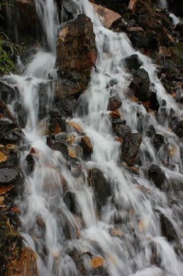
| These waterfalls are just above the road |
I made it to the mine just at 11:00 and took a few pics. The history of mining in these mountains was evident throughout the upper canyon. Definitely interesting for the history buff as well as the hiker.
It had begun sprinkling, so I tucked my camera away in my pack and headed down. I found some wildflowers that I had to try and get some good photos of though, and the camera came back out. The rain still hadn't
 |
| Wasatch mine tailings and wildflowers |
When I was maybe 2 miles back down, a guy came up behind me and passed me. I assumed he was the owner of the other vehicle I had seen down below. That's the only person I saw on the trail.
It's a Beautiful hike with many possible picnic sites and places to rest. If I would've begun earlier, I could've made it to the other mine and possibly the ridge. I will have to keep that in mind for future adventures.
 |
| Looking up at the Wasatch Mine and upper Mineral Fork |
 |
 |
| The Wasatch Mine |


No comments:
Post a Comment