I have spent some time over the years in
Utah's Stansbury Range, but never had I hiked to the top of the highest mountain in it. Deseret Peak towers at 11,035 and is the highest point in Tooele County. It had been on my bucket list, but I had never done it. Yesterday seemed like the right time, so I did it.
The trail begins at the far end of the Loop Campground in South Willow Canyon. After doing the hike, I personally divide it up into three sections. The lower section winds its way up through an evergreen and aspen forest. It is mostly in the shade. The second section begins when you get to a large meadow area. This meadow area continues until up the canyon until you are nearly to the top of the canyon and has a lot of loose, gravel-like rock on it. It wasn't that bad going up, but coming down was killer on this loose rock. This second section ends when you top out on the saddle above the canyon. From that point you can see into Skull Valley to the west. The last section starts here, because the base of Deseret Peak is to your right.
 |
| The early morning sunlight was spectacular on the surrounding peaks. |
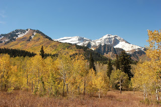
My day began great. The temps were supposed to be high, summer giving one final push to show us who's boss, so I was glad to get up in the mountains. As I made my way up the first section, I was grateful for the shade. I had started at 7:15, and it was nearly 9:00 before I got into the sun. I saw a doe and a Mormon cricket along the trail during this section, and I spent a lot of time taking pictures of both the wildlife (deer, birds, and insects), and scenery on this hike.
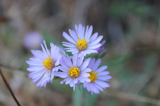
I noticed that most of the wild flowers had died off and much of the plant life was beginning to change color. As I crossed the stream bed of South Willow Creek, it was dry, unlike how it had been when I had been on this trail earlier in the summer. That time, I had turned back because the streak was raging and I didn't want to chance falling in and ruining my camera or phone. About fifteen minutes after crossing the stream bed, I made it to the meadow area. I imagined how green it must have been earlier in the year, and promised myself that I would return sometime to see it.
 |
| After crossing the South Willow Creek streambed, you come to a fork in the trail |
 |
| This Mormon cricket was about three inches long |
 |
| I spotted this katydid on the final approach to the peak |
As I neared the top, I noticed that the trail went right on up, with no scrambling. So this hike, would be suitable for nearly anyone who was in good enough shape to make it, without any worries of having to use your hands to help climb.
Once on top, I took in the amazing 360 degree view. To the southeast, there was something going on at the Tooele Army Depot. They were setting off some charges and I could hear them up there, and see the puffs of smoke in the valley floor.
 |
| Explosions in the valle |
There were stunning views of Skull Valley, and the nearby peaks and I thought that it would be even more spectacular if the forest fires in the surrounding states and in Utah were out and the haze was gone.
 |
| This was another trail coming up to the top from another direction. I told myself that I would one day follow it. |
There was a geocache on top, in an ammo can. It was out in the open. There was another container of notes beside it.
I took the time to put an entry in the pages inside the ammo can.
I then ate lunch, took a few pics, and then just sat there. So often I am so involved in trying to get good pictures, that I fail to actually take in the events that are happening. For this reason, I make it a point now to put the camera away and just spend a few minutes absorbing what I'm seeing.
After about 30-40 minutes, I headed down. When I got to the saddle and started down the middle portion I noticed how tough that loose rock was to negotiate going downhill. By the time the next hour was over, my toes were really feeling it. I finally tightened the laces on my shoes as much as possible and that seemed to help a great deal.
 |
| Looking back up toward the saddle. All the yellow is fall coloring, not flowers. |
 |
| See the bird in the middle of this pic? I still don't know what kind it is. |
I made it back to the 4runner at 2:20. It had taken me seven hours, but I had spent a lot of time taking pics (I took 132 shots during the day) and dawdling. I'm pretty sure I could have shaved at least an hour off that time easily.
It was a great hike and one that you should consider doing sometime if you like hiking.
 |
| This butterfly paused just long enough for me to get a shot. |


