Showing posts with label Uinta Mountains. Show all posts

Sunday, August 19, 2018

Adventure: one way to measure a life

Near the beginning of this year, one of my best adventure buddies, Boyd, found out that he had ALS, also known as "Lou Gehrig's Disease". I had emailed him to find out if he wanted to go skiing with me and our mutual friend Lynn. When he emailed me back he gave me the sad news. We had spent a lot of time together in the outdoors--skiing, climbing Kings Peak (Utah's highest point), hiking at Boulder Mountain, fishing, and many other great outings.
I wanted to know what I could do to help. I figured that about the only thing would be to maybe take him on some short adventures up into the mountains we both love.

Trip 1

The first one, in June, ended up being a drive along the Mirror Lake Highway in the Uintas. I wanted Boyd to do what he wanted to do, so we got out at the Provo River Falls and wandered down the trail.
Boyd's career was as a photographer. He still has the love for a good shot.
Though his disease is progressing rather rapidly, and his muscles are beginning to weaken to the point that he has a challenging time walking, he still wants to be as fully engaged with life as he can be. He told me that as far as his personal case goes, he'd rather not be like the late Stephen Hawking and be confined to wheelchairs or other means of life support. He told me that when he can no longer do anything he loves to do, he'd just as soon go.
I certainly could relate to that. I have told several people that if I ever get Alzheimers, I'm going to go while I still have my thinking ability, and do the riskiest activities I can think of in the hopes of ending my life by a slip or a fall, instead of making someone have to take care of me. He had also mentioned to me that he regretted the summer of 2017, because he had worked so hard to put in his backyard, and his family members and friends had asked him several times to go camping with them, but he had put it off so he could finish the back yard. He wished he would have known was was going to happen. The thing is, we rarely do.
As we walked down to the falls, the only time he asked for help was going down the stone steps. We hung around the falls, taking a few pics, Boyd talking to one guy who had made it out to the middle of the river and sat on a rock just above the falls. After a while, we headed back to the 4Runner, and continued driving up the highway. Eventually Boyd said, "Let's turn off here and go for a hike."
A short hike into the woods--nothing like it!
I pulled off and we got out, following some old dirt road back in, until it ended, which wasn't very far, and we continued on through the forest. We spotted a couple of deer, and maybe a beaver ducking beneath the water in a lily-pad covered pond. At one point, Boyd lost his balance and fell. I had wandered away a few feet and came back to help him up. He was okay. "At least I picked a good place to fall--pretty soft here," he said. We probably walked through the woods for about a half mile, then headed back to the vehicle. "Let's see if your trail finding skills are still good," I said. Within moments he had found our way back.
We stopped at Dick's Drive-in in Kamas and got a late lunch, continuing our conversation between bites. "I would really love a cheeseburger," he said, "but I deal better with chicken strips in these hands."
We talked about going out the next time, how we would drive from Mill Hollow over to Currant Creek. "As long as I'm still able to go, let's plan on it," he said.

Trip 2

We made it out again on July 3rd, and accomplished the goal.
We mostly traveled dirt roads over the top of some spectacular country.


We talked about places we had been and he told me of places I should go--even showing me his favorite fishing spot at Currant Creek. I wanted to try it right then, but we hadn't brought any gear. It was time to go home though. Ann wanted to see me for dinner. When we were nearly home, Boyd pointed up at Mt. Timpanogos and said, "I have never been up on that 'plateau'. I'd like to go up there."
"I went up there last year," I said, "my first time ever. It's called Sagebrush Flat. It's a pretty cool place." We decided that maybe that would be our next trip.
The conversation, like the first time, had been matter-of-fact about his disease and the ultimate outcome. There was no beating around the bush for either of us. "Some people have a hard time knowing what to say to me now," he'd said on our first drive. I just tried to treat him the same way I always had, like my friend. That's the way I want to be treated if I'm ever in that kind of situation.

Trip 3

On July 31st, I picked Boyd up and we headed up to Sagebrush Flat. The road is a continuation of the road that leads up to the Timpooneke Trailhead---one of the ways to the top of Mt. Timpanogos. It's a dirt road that leads around to the west side of Timp. It was actually rockier and bumpier than I had remembered it being, and I thought about how Boyd had mentioned on our earlier trip this summer into the Uintas how he didn't want to go on a certain road because of how bumpy it was. I mentioned to Boyd that I hadn't remembered it being so rough and he said, "It's not that bad. You're just worrying about me." And he was right. It likely seemed bumpier to me because I was remembering what he'd said about that other road, and worried that I had taken him on a road that was too bumpy because of that.
Selfie near Sagebrush Flat

I had climbed up on the rocks to pick some currants.
Boyd asked me to stay up there and he took this pic.

Sagebrush Flat is a Beautiful area with views into both Utah and Salt Lake Counties.
We made it up to Sagebrush Flat and began exploring a little. We talked about how many hunters might be up in that area during archery season. We saw a large buck and a moose, and took some pics. I had forgotten my DSLR and Boyd was trying to get some good pics with his phone. Getting good pics with my phone is really out of the question.
The scenery was magnificent. The friendship, even better. We ended up by picking up some food at Costa Vida and taking it back to Boyd's house and eating it there.
The Sagebrush Flat area. Sweet!

We saw a moose and nice buck up here in Sagebrush Flat. I couldn't
find the pics though.

Trip 4

August 15th was our most recent trip. We made it back to Currant Creek. I remembered that earlier in the summer we had passed through the area during the huge fire up near Strawberry Reservoir, the Dollar Ridge fire, and we had seen flames and tons of smoke along with aircraft dropping water and/or fire retardant on it. I couldn't see any smoke now--at least from that fire. The air was a bit smoky from all the fires further west, but not as bad as it has been this summer.
Boyd told me that we wouldn't be able to make it down to his favorite fishing spot, because they had tried the week before when he came up with some family members, and he had fallen down pretty good. So we made it to an area that was easier to access and set up our stuff.
We caught a couple of eating-sized fish. Boyd had told me that he and his wife Robin love to eat fish. That was fine with me. My wife Ann hates even the smell of them cooking.
It was a team effort. I tied on all the hooks and other gear, baited up the hooks, and cast out the line, and then Boyd reeled 'em in. The weather was nice all day, with long periods of cloud cover and some cooling breezes. We could have sat up there all day long and pretty much did.


Boyd got to reel in the bigger ones, although I managed to bring in
the minnow on the left. Ha ha!


During the time there we had some pretty open and frank conversation. Boyd told me that he had stopped using the BiPAP machine that doctors had wanted him to use to help out his breathing at night. "It's just so uncomfortable," he said--or something like that. He's pretty honest about his approach to life, telling me that if he goes, he goes, and he doesn't want to prolong the inevitable. On the way home we stopped to grab some food, and he accidentally dropped his fries on the floor. He picked them up and still ate them. I had shaken off the floor mat before I went and picked him up that day, so there wasn't any loose dirt on it at least. I asked him "did you get any grit?" 
"No," he said.
I told him that I had shaken off the mat.
He said, "Well, it's not like I care about that stuff anyway. I mean I'm not going to be around much longer, so what's a little dirt." He held up his root beer. "And I never used to drink much of this for health reasons, but now, what does it matter? I can do what I want." I had to admit his logic was compelling.
The haul! Boyd enjoyed reeling in the larger fish. It weighed somewhere
in the 2-3 pound range.

The Next Time

I'm not really sure when we'll be able to get out again. Ann, who is disabled, expressed some concerns about how much time I'd been spending away from her, and not just with Boyd. I had gone on a hike with my brother and taken some of my grandkids out exploring all within the last few weeks.
But that being said, I'm hoping that Boyd and I can continue to get out until he can no longer do it. And personally, I'm hoping that I'm being the right kind of friend--one who cares enough to spend time with an old buddy who's ill. I'd like to encourage all my readers to do the same, and if you're friends with Boyd, go and see him or even take him somewhere fun.

Boyd has been able to keep an upbeat attitude during this ordeal, which is exemplary. I think it would be pretty hard to not get down, but he considers himself to be pretty lucky. And me? I'm lucky to have friends like Boyd to adventure with. It's one way to measure a life.

Sunday, April 01, 2018

Hiking: It's warming up, and time for some nice weather hiking!

I generally don't let bad weather deter me from hiking.
My October hike to the Notch in the Uintas yielded shots like this one.
That being said, once it starts warming up, my eyes light up as I start thinking about the hikes I'm wanting to do sometime between now and next time the snow flies. I never get to do all of them, but one can always dream, can't one?
There are several trips I'd like to make this year. I'll be doing an unscheduled one this month, so I won't count that one. Most of the ones I want to do this year require the snow to be pretty much gone. In May, I'm going up into the Stansbury Mountains to follow a road/trail called "Mining Fork Road". I was on it a couple of times in 2016 and never followed it all the way up. It ends at South Willow Lake, which I'd really love to see. I also want to follow the road down as far as it goes, because I've been unable to locate where someone might get on it and drive partway then hike the rest. So, that's on the agenda. Whether that will take one day or two, remains to be seen.
On the trail to the top of Deseret Peak in the Stansburys
Second on the list is the Pfeifferhorn. It has been on my list for a number of years and I haven't ever made it.
There are a number of other peaks that I have climbed before, but would like to do again. If I do them though, I want to do them with someone this time. I've been a solo hiker for a long time, simply because of my schedule, but I'm wanting to share the experience with others on these peaks. The peaks are Timpanogos, Nebo, and Deseret Peak. I also wouldn't mind doing the relatively easy hike to the top of Baldy in the Uintas if someone were to tag along.
Some of my best hiking partners are my grandkids.
But I also like taking other family members and friends along.
Of course, I'm open to other hikes that aren't as strenuous as the three tougher hikes mentioned above. Hikes to some of the Uinta lakes for a little fishing and relaxation are always part of my agenda.
If I could, I'd do a backpacking trip. I'd really love to go to Red Castle in the Uintas as I have never been there and I've heard a lot of great things about it. One of my friends would really love to go to Kings Peak with me, and I'd do that one again if I could swing the time away from home. My wife. Ann is disabled and hasn't felt comfortable with me going away over multiple nights, or even one night for several years. She has hinted that she might be open to it in the future though, so here's to hoping.

I imagine I'll do my share of solo hiking as well. Maybe up to Silver Glance Lake or elsewhere in the Wasatch. No matter what happens though, it will be great to get out and experience whatever the good Lord allows me to experience. I will be counting each adventure as just a bonus to an already amazing life.
Sometimes ya gotta go it alone if ya want to get out there.

Saturday, March 24, 2018

Southern Utah hiking is great fun!

This past week my wife and I had a chance to get down to southern Utah for a bit of relaxation. She has been disabled enough that we haven't been able to go out on the road overnight for around a year and a half. Over that time, she has been gradually improving and we decided to give it a try. I wrote about the rest of our trip in another entry, so I'll just tell you about the hiking I was able to do.
From our lodging in Hurricane, I could see a trail on a nearby mountain. We were staying at an Airbnb place, which was nice and described in more detail in my other post. We were only going to be there for two nights and that trail was nearby so I thought I'd give it a go. I asked Paul Maag, one of the owners of the rental, about the trail. He said something like, "Oh yeah, that trail goes all the way up to the top of Molly's Nipple. This is a good time of year to go as the snakes won't be out. I wouldn't go up there once it gets past ninety degrees. They come out then." I had looked for a place to park the night before near where the trail began, and so that morning as it was getting light, I parked there. The sunrise was awesome!
My arrival at the trailhead, perfect sunrise timing!

In between the parking area and where I could kind of see the trail, there is a wash that comes out of a slot canyon that needs to be crossed. I crossed the wash looking for where the trail began and it looked like it went up some really steep stuff right at first. I began looking for another way up, because the way I saw at first looked like a good way to slip and get hurt. After ten of fifteen minutes of scouting around further up the canyon, I decided that I wasn't going to make it up that slope on that day and instead decided to follow a trail up into the slot canyon. The thing was, it was looking like rain and I didn't want to be in there if it really started coming down. The little pockets of water I was seeing from a previous storm, and the dark clouds above made me nervous. I only got up in there about two hundred yards before turning around. Ann likes me to bring home some cool looking rocks on my outings to put in the yard and so part of that little side trip was hunting for something cool to take home. I found a couple of rocks and headed back down the canyon, then back to the van.
Once back at the van, and in the better light, I spotted a gate, about fifty yards further to the west of where I had crossed the wash. I bet that's where the trailhead is, I thought. Once through the gate, I knew that was where I needed to go to climb that peak. I headed up the trail.
It was still early. I had a deadline though because we needed to leave at about 11:00 in order to make it back home for a viewing for my aunt who had died. I decided that I would hike uphill until 9:00, then turn around. It was a steep climb and a lot of the trail was made out of that chalky, white dirt that turns very slick when wet, while other parts of it had a lot of loose rock on it. I knew that if it started raining hard, it was going to be an extreme challenge getting down in one piece. I modified my original plan of turning around at 9:00 to include unless it starts raining.
The first item on my agenda was to make it to this outcropping of rock.
I made good time. The lower elevation than I was used to in the Wasatch and Uinta Mountains made it seem much easier to hike without getting out of breath, and the stairclimbers I'd been doing hadn't hurt my ability to climb in the least. Within about 45 minutes though, I began feeling drops of rain. About two hundred yards above me there was a rocky outcropping and I made that my goal before turning around.
The views from there were amazing, and I could look down into the slot canyon and see what looked to be actual pools of water.
To the southwest, a Beautiful array of farmland.

The view to the northwest included Pine Valley Mountain

The slot. Down in the bottom about mid-pic was what appeared to be pools.
I stopped for a moment, took some pics, and headed back down. It wasn't yet 9:00, but it was time go go back because of the oncoming storm.
As I descended, I was thankful that my experience as a hiker had warned me to be careful. The steepness and looseness of the trail was treacherous enough, and I was glad that it was only lightly raining at that point and not enough to turn the trail into extremely slick mud.
Just to prove I was up there.
When I made it back down I drove away, stopping to look back and take some more pics of where I'd been. I could tell that in another half hour, I'd have made it to the top of Molly's Nipple.
I made it to the second "hump" in this photo. Molly's Nipple still isn't visible from here.

From another angle: I had made it to the top of the prominant cliffs before turning around.

From a distance, the trail and the peak.
Like many more trails that I hadn't completed, there would be a time to come back, should I desire. I'm thinking I will. Those unfinished trails always call me back sometime.

Saturday, September 09, 2017

Hiking: Bald Mountain and Fehr Lake

This past Tuesday I wanted to get out, get hiking and try some fishing. Mostly, I wanted to get into the Uintas as I hadn't had the chance to go there yet this year. I had debated which lake I wanted to hike to in order to fish, and I kind of wanted to try somewhere new. Then I decided to hike to the top of Bald Mountain, a relatively short hike, and come back down, then hike to one of the lakes off the same trailhead that goes to the top of Baldy.
I had told my wife that I'd be back at around 4:00, so I had to keep that in mind as I was figuring things out. I driven out of the gas station parking lot in Taylorsville at around 6:20 and it was just shy of two hours drive time by the time I got there. I had stopped to go through the McDonald's drive thru at Park City, and to pick up a fishing license, some worms, and some Power Bait at the grocery store in Kamas. I didn't need to pick up a pass at any of the kiosks or whatever you call them along the Mirror Lake Highway, as my pass that I had purchased the day before, when my wife and I took a drive up there, was still good.
Saw these deer on the drive up. Just did a drive by experiment with my zoom.
As I began hiking, I started thinking that maybe I should've brought the short-sleeve shirt instead of the long-sleeve, because I was working up a sweat. And I had not been up at altitude like that all year--Bald Mountain Pass clocks in at over 10,700 feet, and the trailhead itself is just a bit lower than the pass. My legs were fine from all the stair climbers I've been doing, but I found myself lightheaded as I tried to adjust to the thinner air.
There was only one other car in the parking area when I began, which was quite a change from the day before, which was Labor Day. That day, there was wall to wall people all through the Mirror Lake highway area. In fact, on Monday we had got caught in bumper to bumper traffic coming back from our ride--people from the Uintas, and likely Strawberry Reservoir and other areas too. Tuesday was completely different and back to nearly normal levels of people, though there were still a few campers and motor homes belonging to people who probably wanted to stay up for a few more calmer days.
As I began my ascent, I could tell it was going to be a low visibility day due to the smoke from all the fires that had accumulated amongst the peaks. At that point I was not aware of the Weber Canyon fire, and thought that most of the smoke was blowing in from other states.
It's quite a slope, both to the right and left as you go up the trail.
I kept it slow to better adjust to the altitude and took a lot of pics along the way.
This is about where the woman who had climbed it 100 times passed me.
One woman passed me on the way up and then, just as I neared the top, she passed me on her way down. We stopped and chatted for a few, and I found out that this was about her 100th time climbing this particular peak. I had just heard a couple of weeks ago about a retired mail carrier who had hiked to the top of Mt. Timpanogos more than 900 times. It made me wonder. I mean, there are so many different trails to take, why do one particular trail that many times? But to each his or her own. I have hiked several of the trails in the Wasatch around five times and Mt. Olympus maybe ten times. That would be my personal record. The most times I've hiked any one particular peak. And I don't necessarily see me doing Oly again. So many trails, so little time!
After talking to that person, I got up to the top and hung around for a while, finding the exact top with my GPS (this mountain tops out at 11,943 feet) and then going to various points to see the 360 degree view.
Looking to the southeast. That's Mirror Lake directly below.

A little to the northwest is the Notch.

Another view of Mirror Lake and Highway 150

To the west. Among those lakes are Trial and others.

Reid's Peak

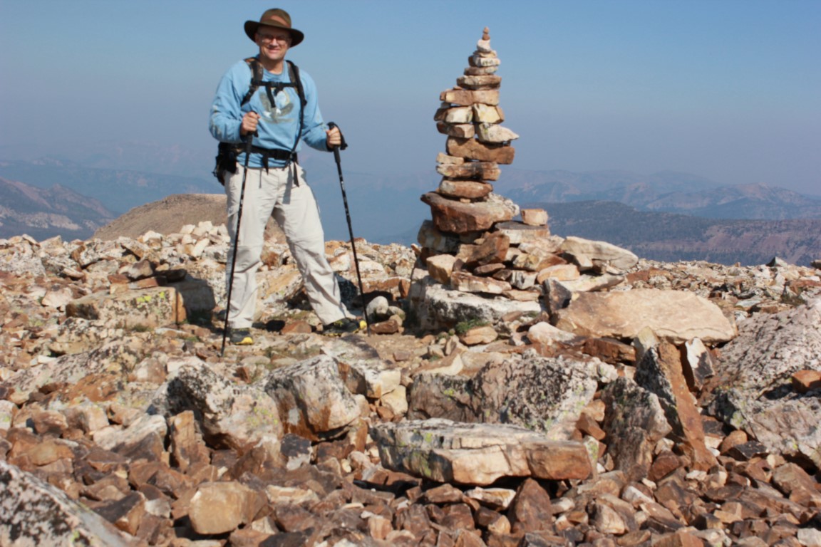
Large cairn on top. The actual high point is where I am taking the picture.
After eating my second breakfast, I headed back down. On the way, I met a couple of people from New Zealand who were camping nearby and enjoyed my visit with them. before I even got to the trailhead, I realized that I wasn't going to be able to hike into even the nearest lake along the other fork of the trail. This trail eventually leads to the Notch, and one can do a point to point hike if you start here and end up at the Crystal Lake trailhead, or start at that trailhead and end up at the Bald Mountain parking area. I certainly want to do that one some day. I have hiked from the Crystal Lake trailhead over the Notch and down to Ibantik Lake and that is a fabulous hike.
Anyway, I had spotted a lake on my map on top that was only about a half mile from the main highway, and I drove down the highway to the parking area, then hiked into Fehr Lake. I figured I had about an hour and a half to fish in order to get home by the time I had told my wife.
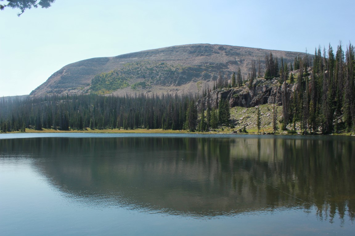
Fehr Lake is a Beautiful little lake.


Can you find the guitar in this image?

There are other lakes further back in. As I said--there are so many hikes, and I love Timp and all, but could never see me doing it even 100 times--just too darn many other places to see. One of these days, I'll get back on that trail and see the other lakes that were further in.
Views along the trail to Fehr Lake
Since I had an hour and a half, I just decided that my best course of action in catching fish was to try something for 20 minutes, and if there were no bites, to try something else. I first used worms. After all, I had stopped and bought them in Kamas, so I figured I'd better give them a try. Nothing. The Power Bait was next--rainbow with sparkles. Again, nothing. I decided to try a fly with a bubble. I used a brown scud and a fish took it, right after it hit the water. I reeled it in. If I had my backpacking stove with me, I would have cooked and eaten it on the spot, but I didn't, so I let it go. I let nearly everything go when I fish as it's rare for me to have my stove along, and I never take them home.
I tried the scud a few more casts, but got nothing. I figure that the fish hit it on that one cast because it was still basically dry and they were feeding on the surface, but after that first cast, it was waterlogged and sunk. Something to think about for the future. I should take my fly rod next time and that stuff that makes flies float.
I switched to spinners and caught nothing except an empty plastic cup that some uncaring person had thrown down, either in the lake, or on the land and then it had blown in. Either way, I didn't like it.
You can stop leaving your trash in the mountains at any time. I won't complain.
The trail back out afforded me a great view of the peak I had summited earlier that day.
Bald Mountain
I knew I would be back to climb it a fourth time some day---probably in my golden years--and then stopping in the forest below for a picnic or something. One thing I knew for sure--I would never run out of places to hike, for the first time, or for the seventh. And it's always a new adventure.